Major Geographical Land Features on Fanar
(Elvish names in parenthesis)
Briarwood (Dol Shaelyn) – this forest was thick with trees and undergrowth. In the center of the forest was Dol Melerith, the Elvenhome of King Aeris and Queen Ilnaya, who founded the kingdom not long after the Shadow Lord rose. The southern part of the forest is under the care of the Empire of Endiron.
Cliffs of Mist (Arn Oshe) – Located in northwest Fanar, these steep cliffswere shrouded in mist and nearly impossible to climb. Dael Vyrnyn grew on the plateau at the top.
Crimson Dawn Hills (Asha Brae Aeryll)– Located in eastern Fanar, these hills were named for the reddish tint they took on at dawn due to high concentrations of iron ore.
Daladorn Mountains (Riva Daladorn) – Located in the northeast, this range, the tallest in Fanar the range was named for the legendary clan priest of the Elder Days who made the magical forge bearing his name. Caradar’s survivors settled here after the Reckoning with Daladorn’s Forge, one of the few relics saved from destruction. The Principality of Jeheris and the Kingdom of Vanerum both lay claim to parts of the mountains, but the Forge Folk do not recognize either nation as sovereign over them.
Dragonback Ridge – this ridge running northeast to southwest forms a barrier between the Dael Vyrnyn and the Swordfist Plains.
Firewind Mountains (Riva Waelfyr) – this range of mountains was in southeastern Fanar in the kingdom of Orland. Mirror Lake is in a valley nestled in the center of the mountain range.
Forest of Twilight (Dael Vyrnyn) – Located in northwest Fanar, this ancient forest was the home of the Fair Folk living under Kandol’s benevolent rule. Protected by cliffs on two sides and the Dragonback Ridge on the other, a pass to the south was the only easy way into the forest.
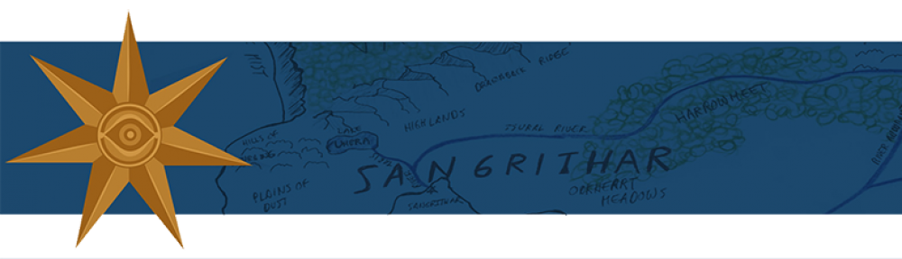
Harrowmeet (Dael Lynorn) – Located in the Empire of Sangrithar, this forest was a dark and dreary place filled with natural predators and the occasional Dark One.
Irontooth Mountains (Riva Myrvaen) – Sandwiched between the Sangitharian Empire and the barbarians of Angrakor were the Irontooth Mountains. The lowest of Fanar’s mountain ranges, most still choose to go around the steep slopes, rather than cross them.
Mountain of Clouds (Pel Aesylle) – Located in the Forest of Twilight, this solitary mountain towered over the Dael Vyrnyn’s canopy and was home to Kandol Elf Lord and his Fair Folk.
Northern Steppes – Located on the northern shore of Fanar east of the Whispering Hills, were the Northern Steppes of the Humadin, a dry region alternating between rolling dunes and badlands.
Sarhaven Sea – this inland sea lay in the northeast part of the continent, just below the Daladorn Mountains. Nearly a thousand miles across, it contained several large islands.
Savage Plains – Located on the southern coast and considered part of Angrakor, these plains were the domain of the southern barbarians.
Shadowgrim (Laen Erlorn) – this large swamp was a very nasty place filled with Dark Ones. In the center of the swamp was the Isle of Dread, home to the Shadow Lord, an ancient nameless evil (he did have a name long ago, but no one would say it after the BUN).
Silverwood (Dael Glymyrr) – this forest was more lightly forested than the other forests of Fanar. It is named for the Sildarion trees that grew only there, silver barked birch trees with silver bottomed leaves descended from the Sildar tree. Tarik convinced me that these trees were descended from the Sildar growing in his parents grove during the Elder Days. .
The Hills of Mourning – (Asha Solessa) Part of the Sangritharian Empire, these hills, located south of the Dael Vyrnyn, were thick with peril and Skulfs. Queen Averanda’s heir died here and ever since, the wind mourned her passing.
The Hollow Marsh (Hazrah Faen) – these fens lay between the Sarhaven and Eastern Seas. The northern reaches were under the protection of the Principality of Jeheris. The lightly populated region was part marsh and also contained large tracts of land.
Valley of the Maiden – Between the Northern Steppes and Briarwood lay the Valley of the Maiden, named for the goddess of the Elder Days.
Whispering Hills (Asha Taemyr) – Located near the northern coast of Fanar, this range of hills was named for the whispering winds ripping through them. A wild and mostly unsettled region.
Bodies of Water
Rivers
There are many rivers on Fanar
Lakes
Lake Umbra – located in the Kingdom of Sangrithar south of Dael Vyrnyn
Lake Hiffrim – located between the Irontooth Mountains and the Briarwood
Mirror Lake – Nestled in a valley in the center of the Firewind Mountains
Oceans and Seas
Calisende Channel – named for an underwater city of the Elder Days, this channel separates the continents Fanar and Shurlind.
Indallar Ocean – named for a legendary mariner of the Elder Days, this ocean separates the subcontinent Tyrnavalle and Shurlind.
Northwind Ocean – the ocean north of Fanar, beyond which are the southern shores of Kandagard.
The Straits of Rabyn – named for the mad Lord of the Depths because of the legend that Tyrnavalle was once part of Fanar until, in a fit of rage, Rabyn tore it from the mainland.
The Eastern Sea – a vast ocean to the east of Fanar, the Eastern Sea stretches for thousands of miles before hitting the western shores of Shurlind.
The Shining Sea – Hundreds of small islands dot the northern half of this sea, which separates the subcontinent Tyrnavalle from southeastern Fanar.
The Straits of Rabyn – named for the mad Lord of the Depths because of the legend that Tyrnavalle was once part of Fanar until, in a fit of rage, Rabyn tore it from the mainland.
